Routes
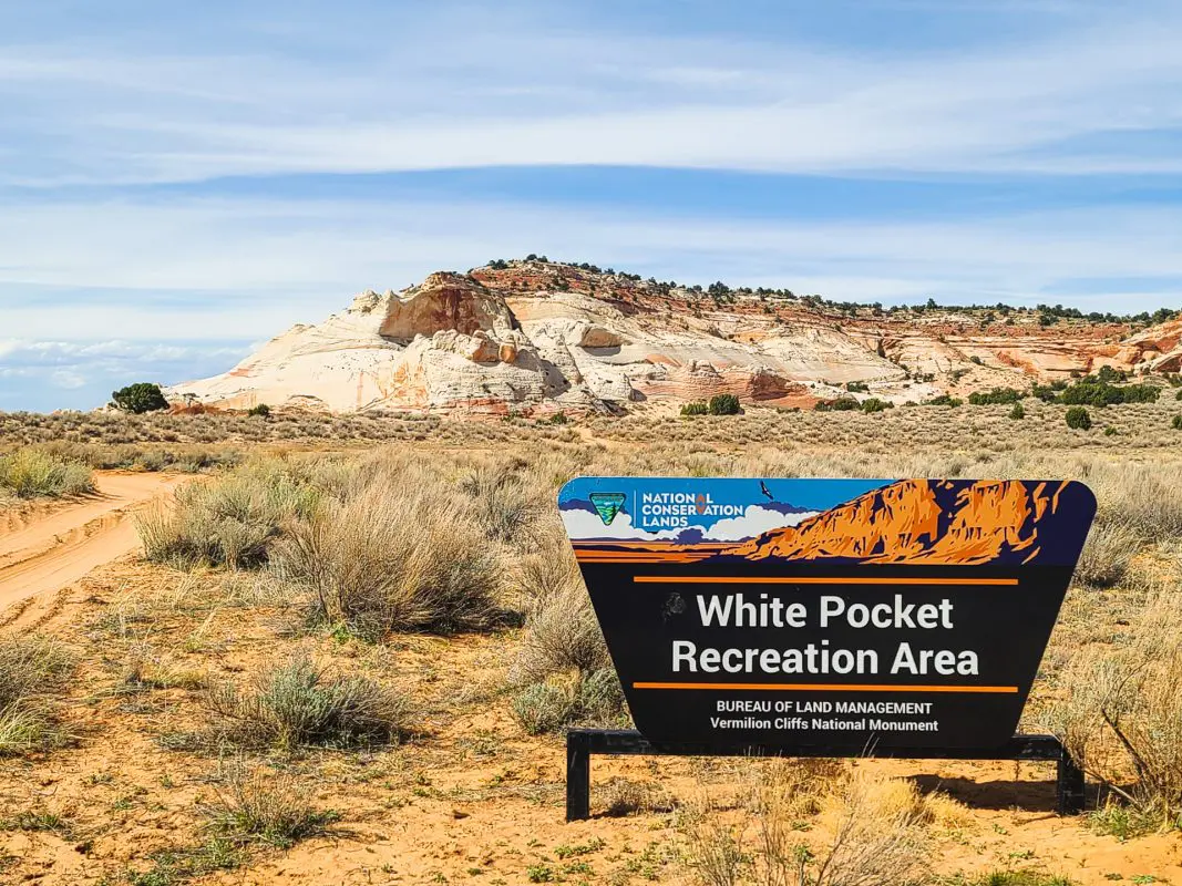
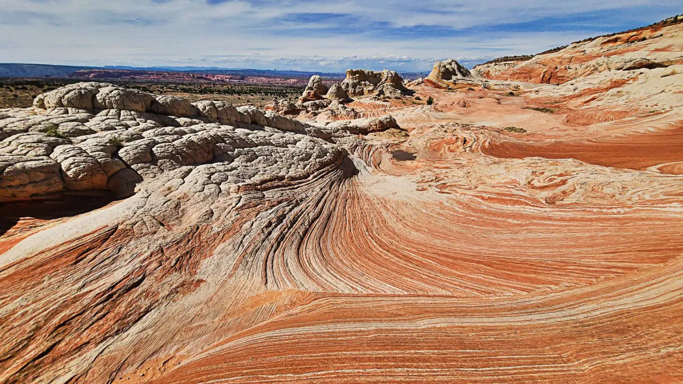
White Pocket

“Adopt the pace of nature: her secret is patience.”
―
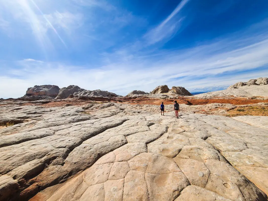
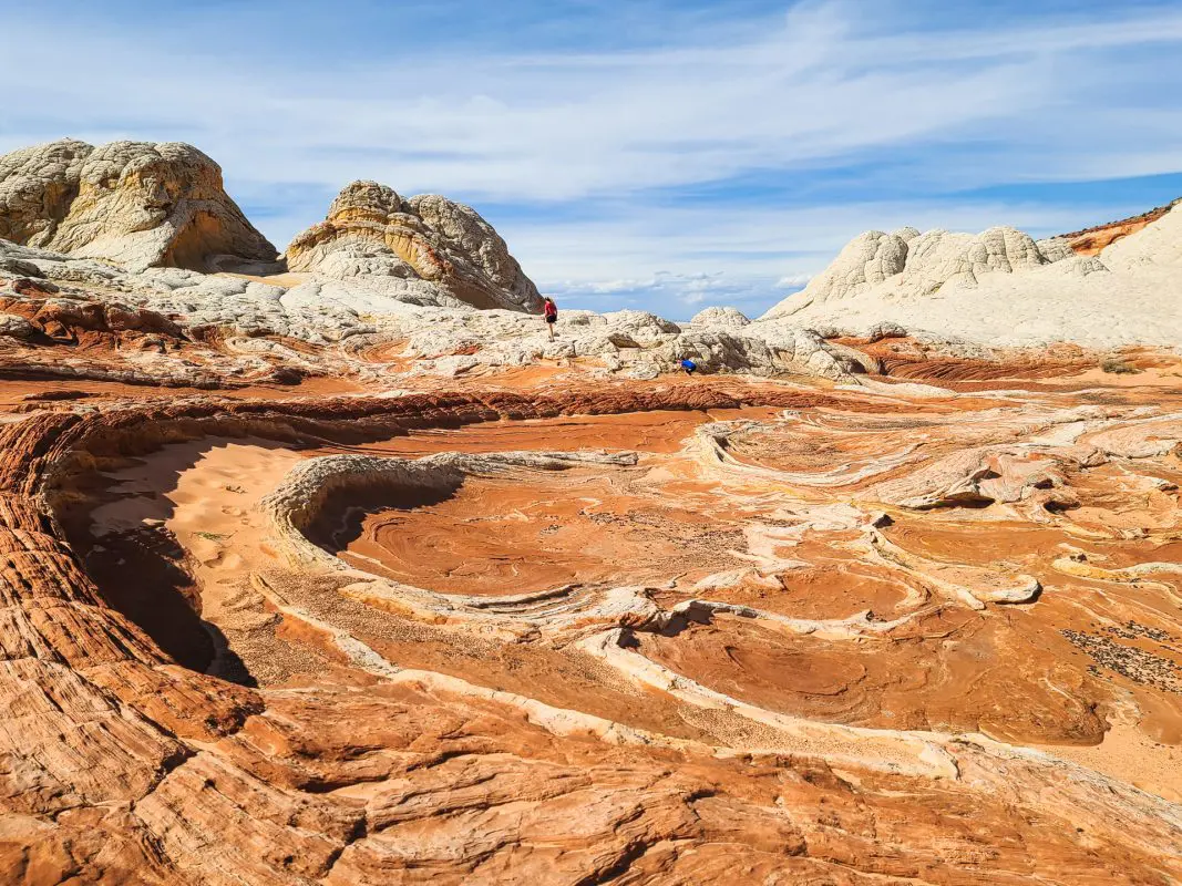
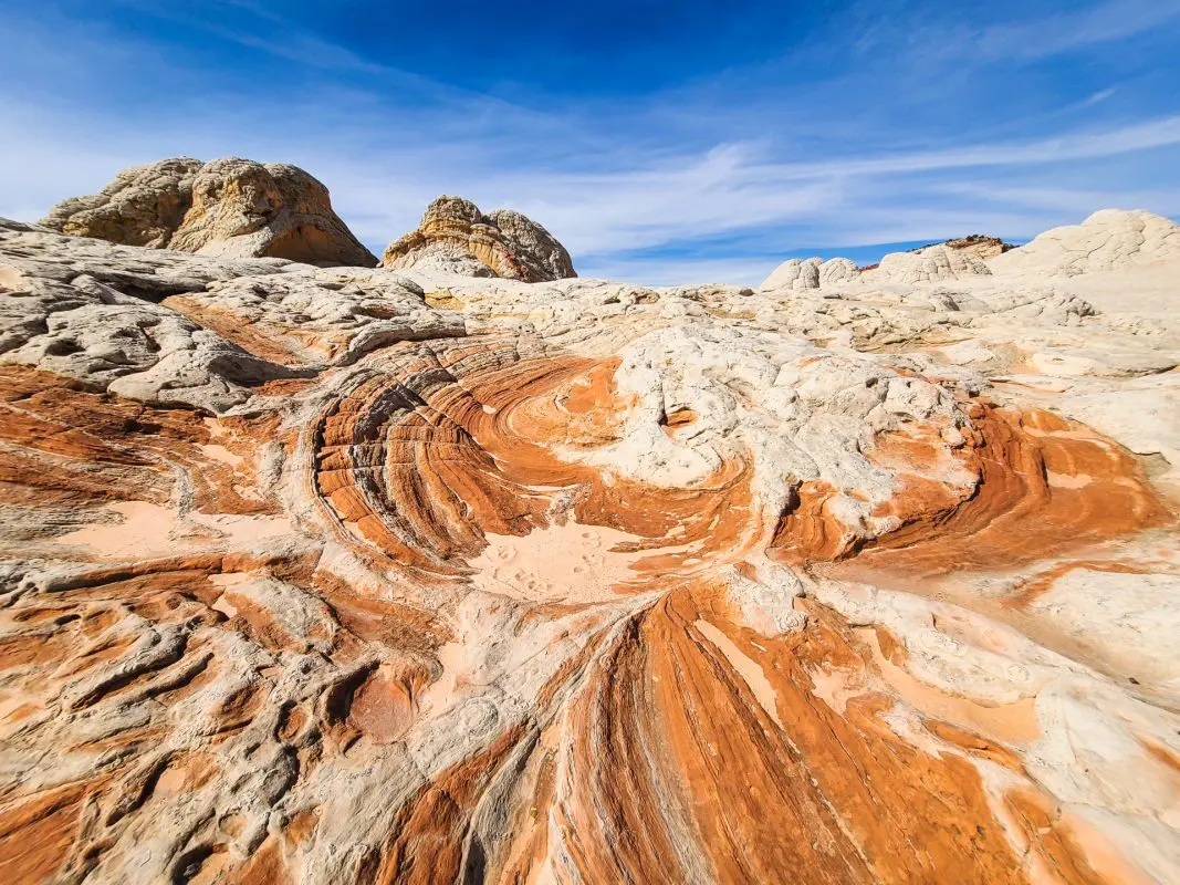
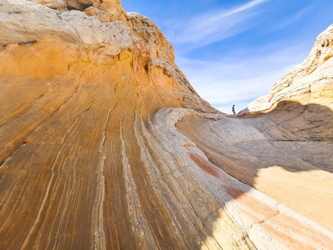
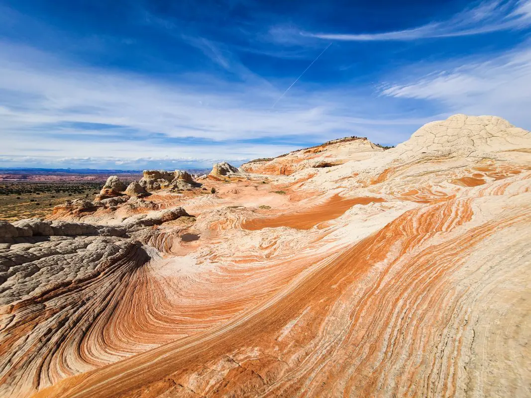
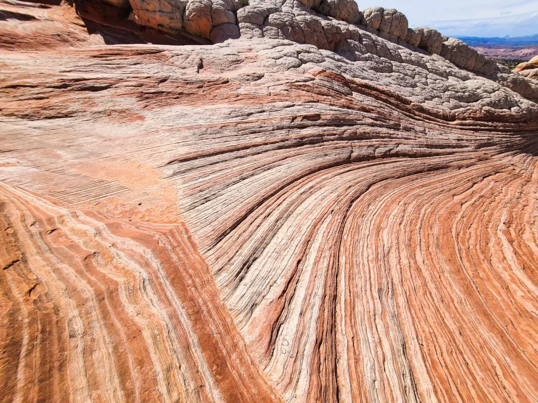
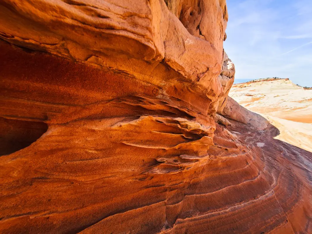
I don’t throw this around lightly, but White Pocket is one of the most amazing natural land features I have ever seen. You could literally stare at this place for hours and continually be amazed at the grace and power of nature and time.
Off We Go!
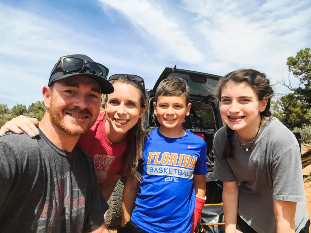
This trip has been on my wife’s bucket list since we started going west on yearly road trips several years ago. Being a science teacher, she really geeks out on these types of trips. Personally, I had mediocre expectations. However, I could not have been more overwhelmed with the geology featured at White Pocket.
We departed from St George and made the lengthy, 75 miles of asphalt, drive. After driving through some amazing scenery as we traveled up and out of La Verkin, past breathtaking cliffs (with mountain bike trails on top), there was no shortage of scenery to keep your eyes occupied.
Continuing on through Colorado City, AZ, one of the more colorful parts of the southwest, we eventually made it to Fredonia, a quaint little desert town and the last stop for gas before leaving the asphalt.
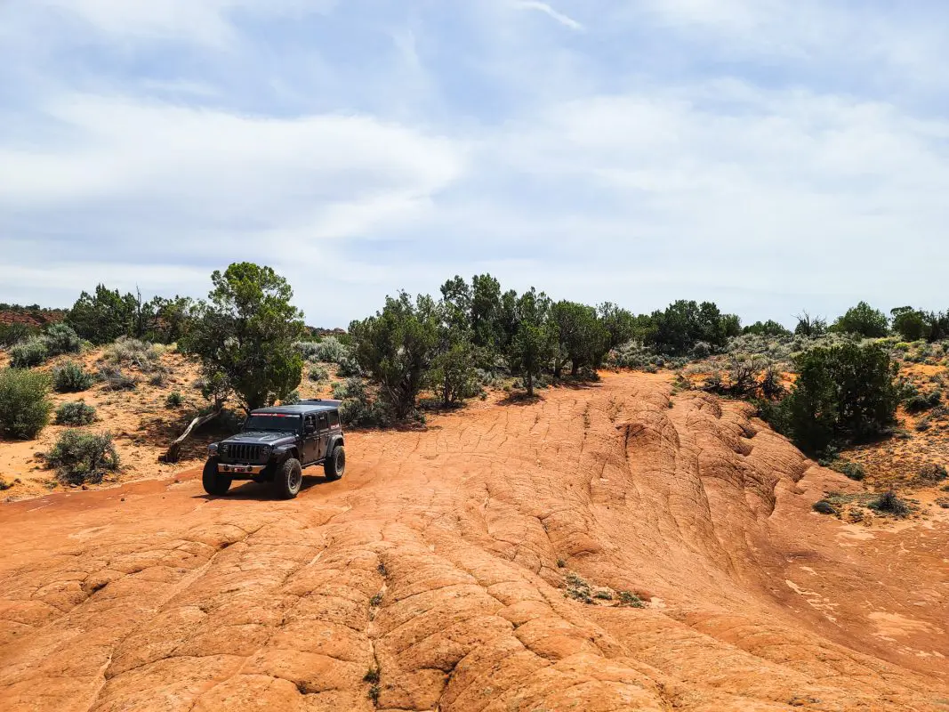
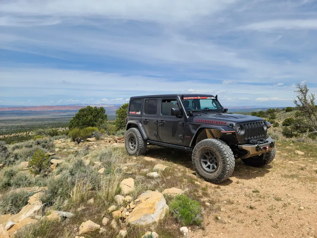
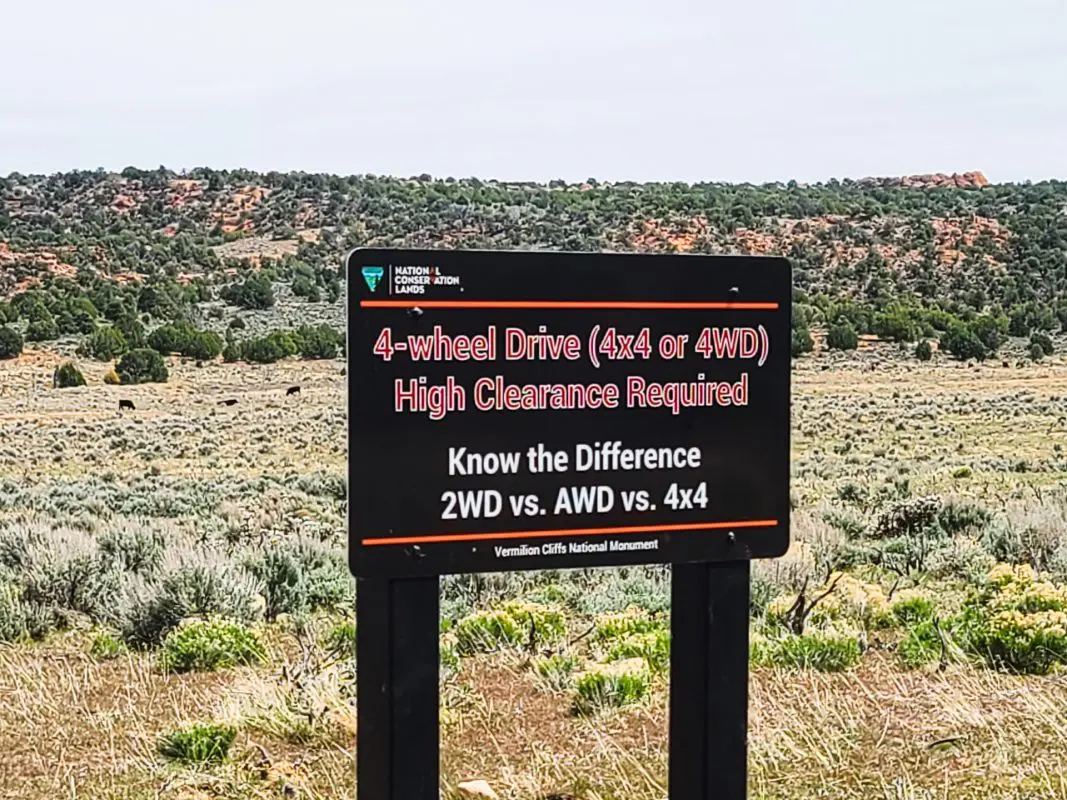
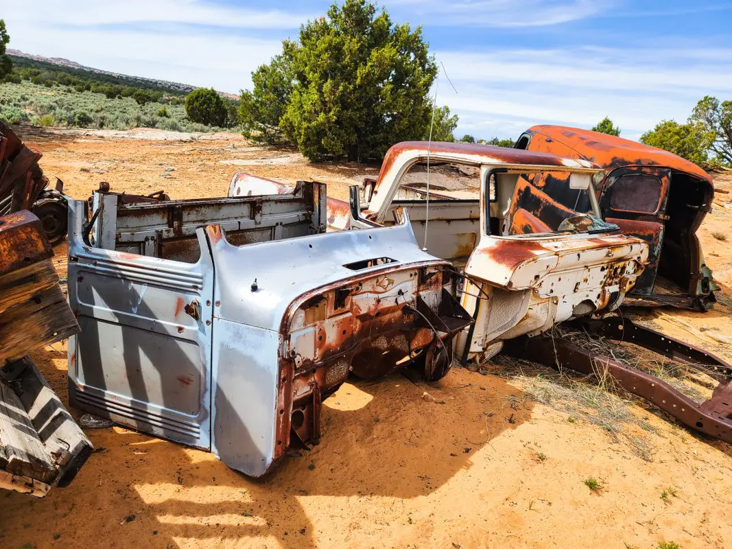
The initial terrain is that of hard packed desert with the occasional small rock crossing. A 2wd vehicle with moderate clearance would be more than sufficient for these roads. As you make you way up and out of the valley, the road condition worsens slightly. We did not use 4WD in the Jeep, but a little more clearance and attention to line choice was necessary.
After cresting on top of the plateau, you are dumped into some heavy sand. There are alternate lines to help you avoid the sand, but we took it as a challenge and powered through without issue, but definitely in need of 4WD for the sand. If traveling this direction, make sure that you look back every so often. The views from up top are amazing.
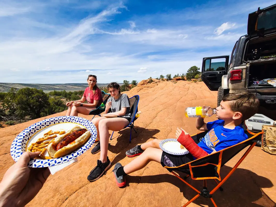
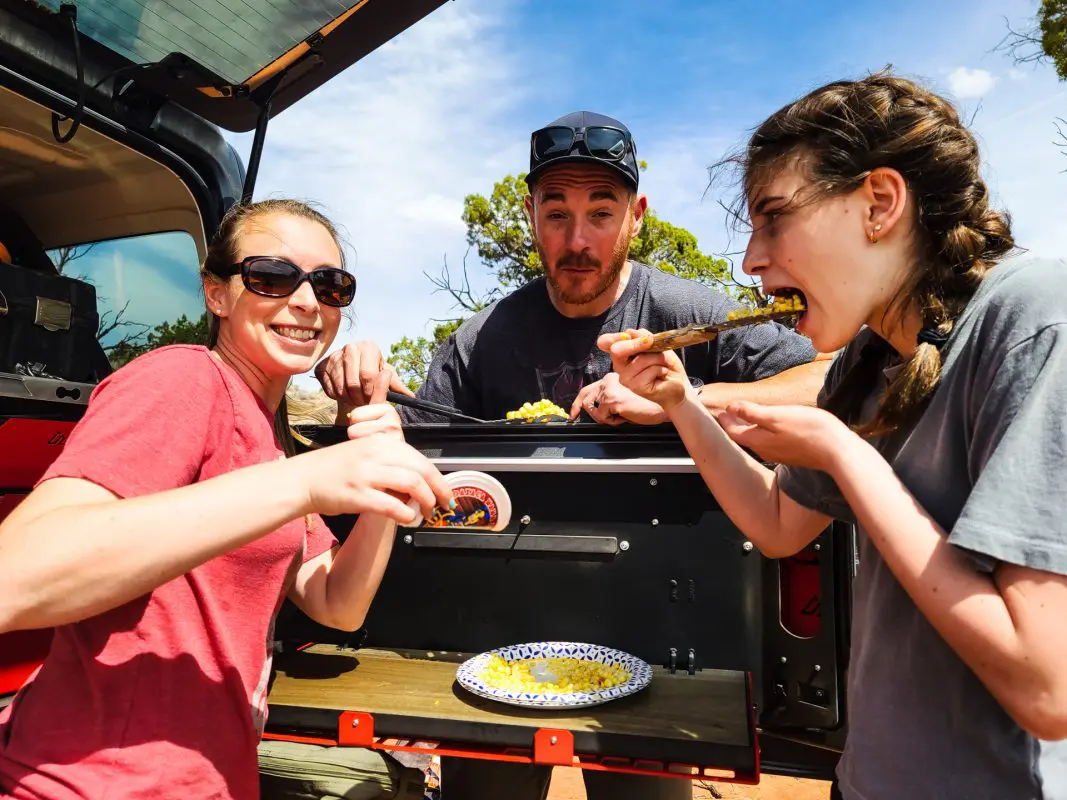
Lunch was setup at a really cool spot overlooking the valley with a good amount of flat area to spread out. It was a little windy here, so be prepared for that just in case.
Jeep JL Overland Organization
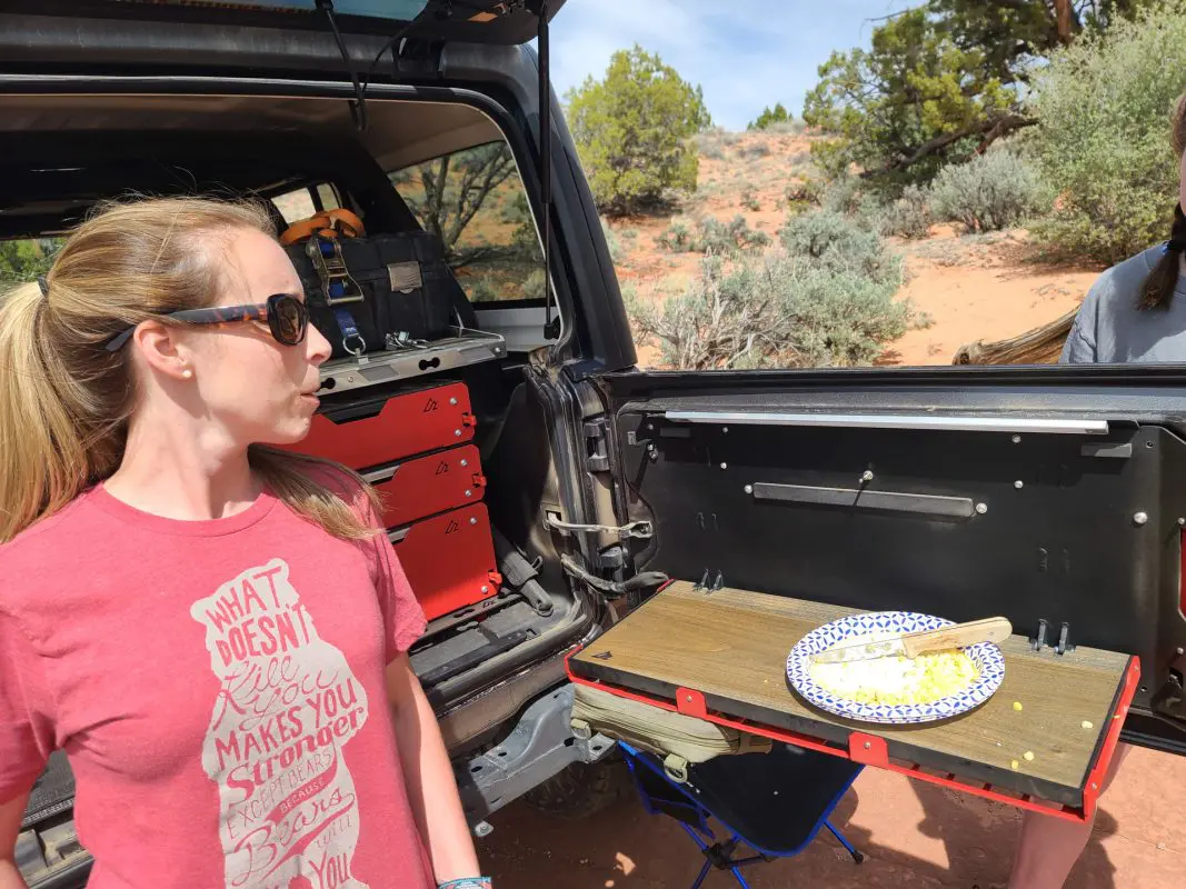
Our lunch setup was made more enjoyable and organized with the use of our M.A.S.S. cargo components. We also put the new VersaTable and Cargo Shelf to good use!
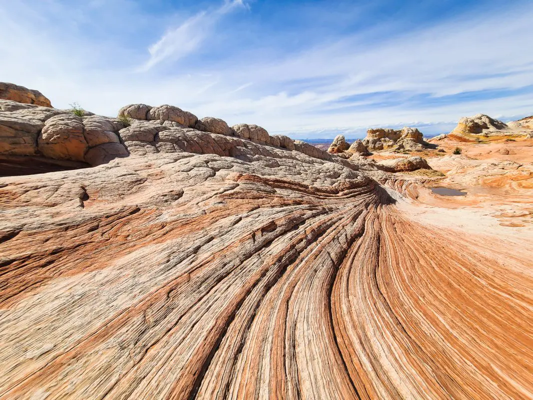
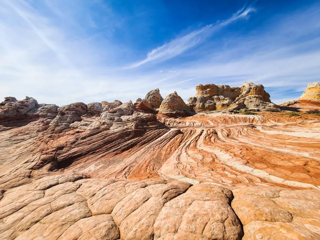
After lunch, it was back on the road/trail to head to the main feature, White Pocket. I honestly had pretty low expectations, but seeing this in person is pretty awe inspiring. The amount of time and geological magic it took nature to build this place is unfathomable. These photos really don’t do it justice. White Pocket needs to be towards the top of your bucket list.
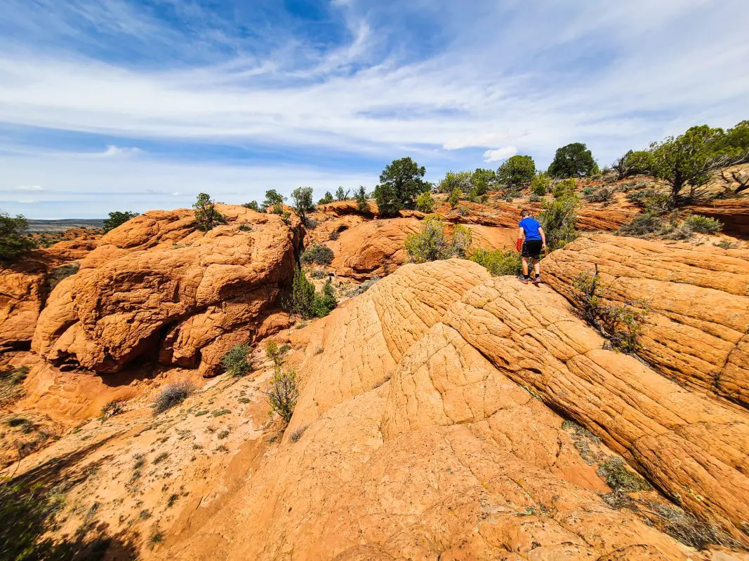
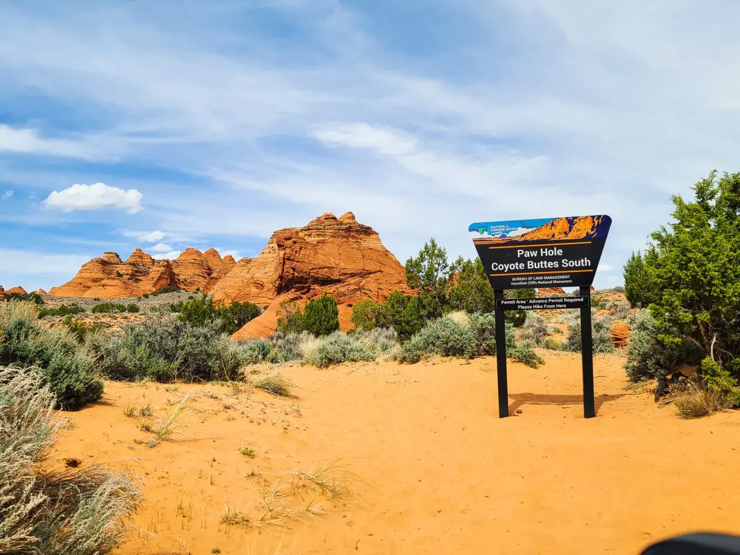
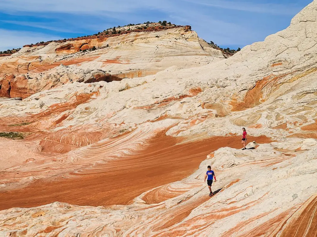
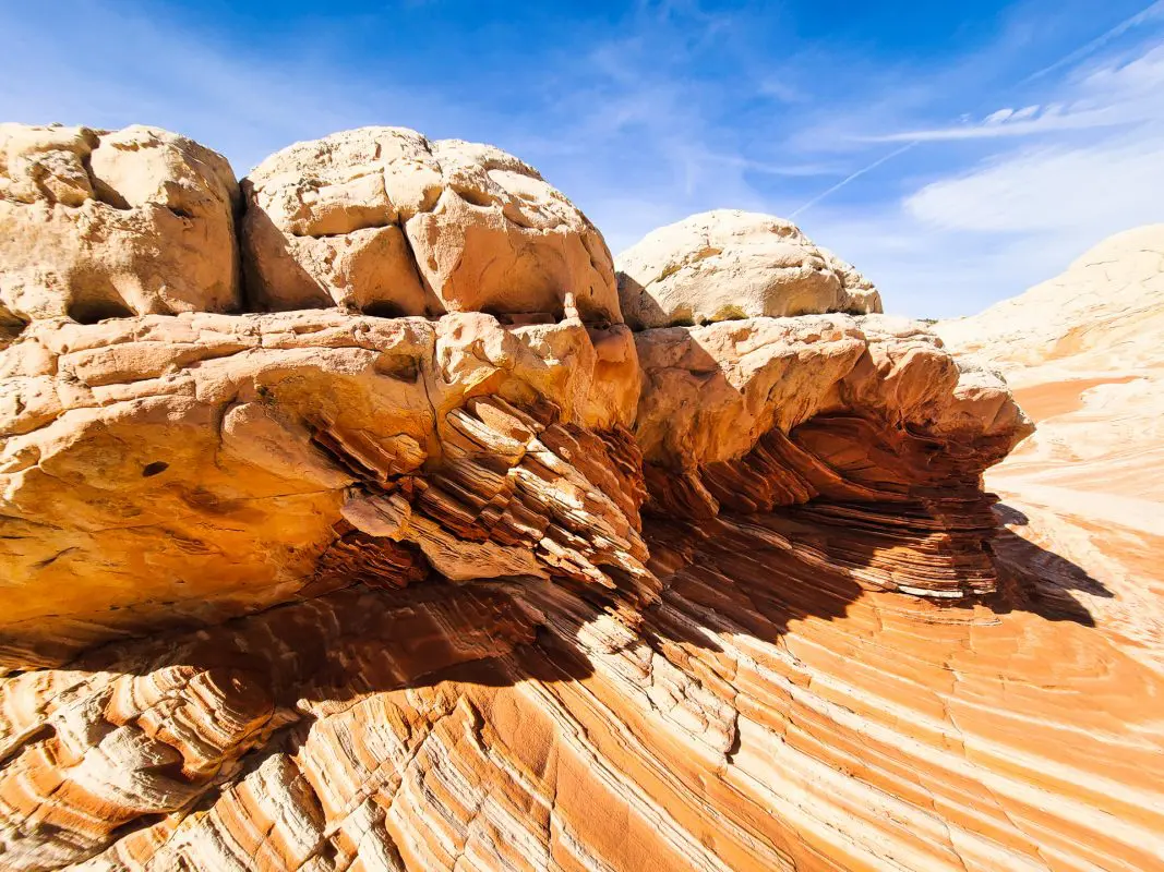
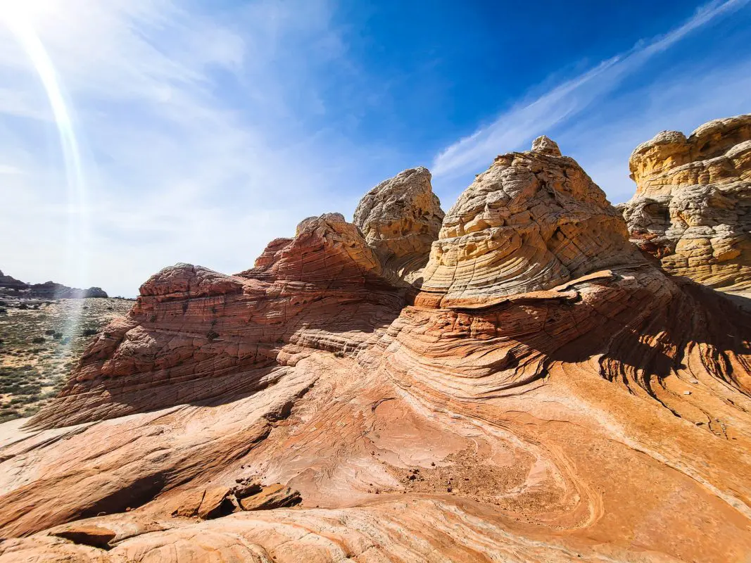
When arriving at the trailhead to White Pocket, you are faced with a few different hiking options. We opted for the main route from the parking area. After no more than a half mile of walking in sand, we arrived at the beginning of the rock formations.
White Pockets gained its fame over the past few years due to its similarity to the Wave (located not even 6 miles away) but without the pesky lottery permit requirement. This area is sparsely visited due to the deep sand and 4 wheel drive access requirements. However, White Pocket is approximately one quarter of a mile wide which is much larger than the Wave. Hiking access is also shorter and less strenuous making this geological wonder much easier to physically access as long as you can get through the deep sand!
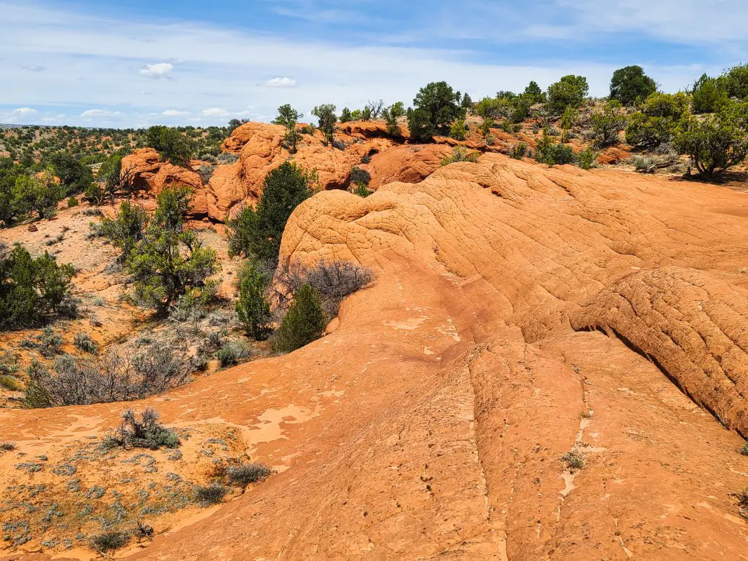
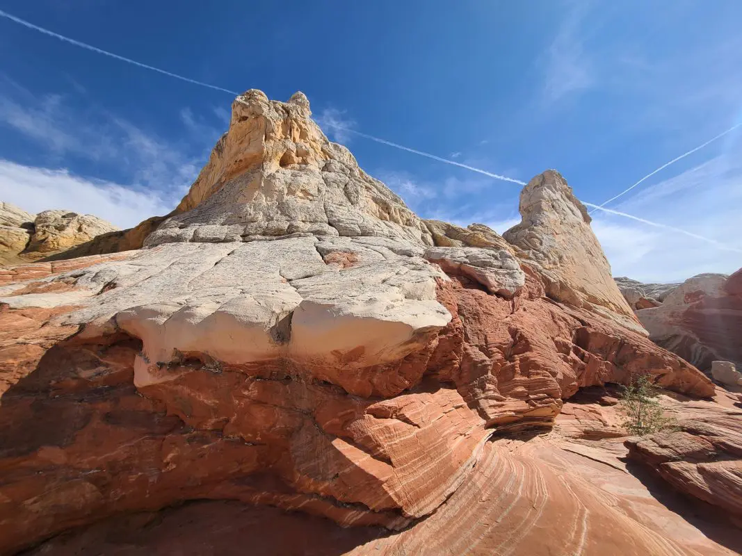
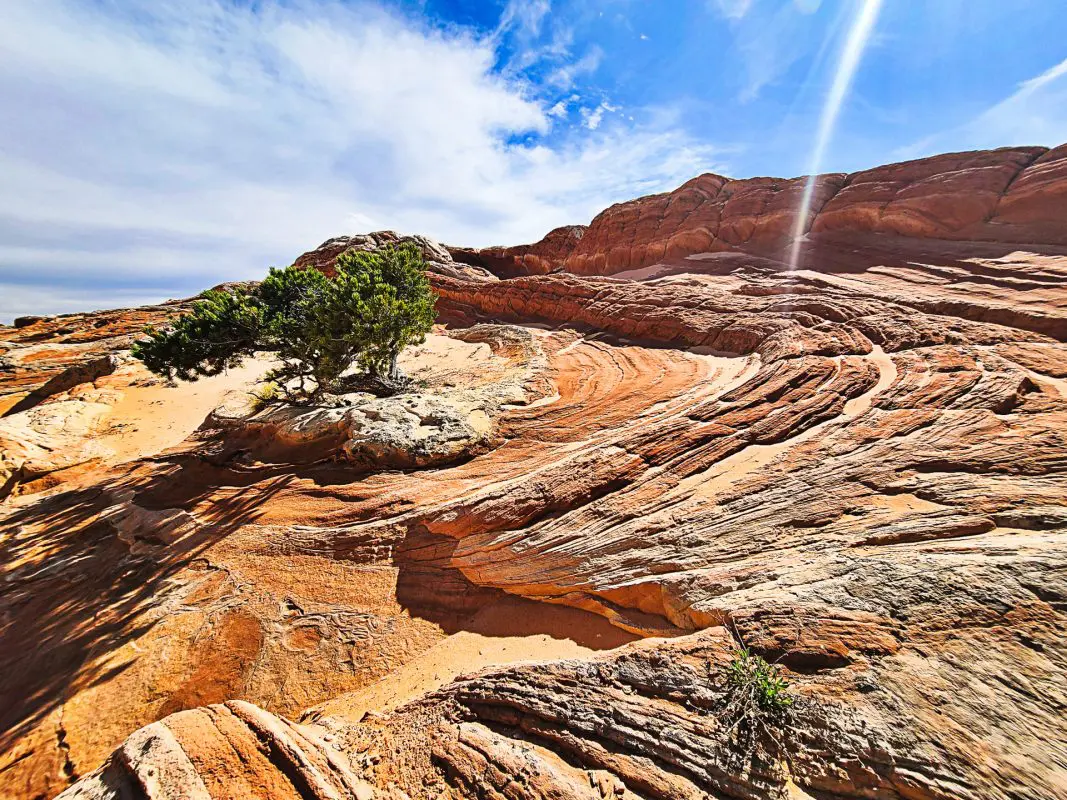
After traversing and climbing our way to each edge of the formation, we hopped back into the jeep to take a trail option to another close rock formation. Marked with “Deep Sand, Dead End”, we took the road less traveled and found an amazing camping spot on slick rock with shade and sand. It was definitely deep sand, but doable. This short side trail led to more hiking options.
Geologists are unsure of the origin of White Pocket. Most agree that volcanic activity and landslides played a large part in the formation. The unknown explanation coupled with the striking beauty of the rock make this a must see destination.
Photo Gallery
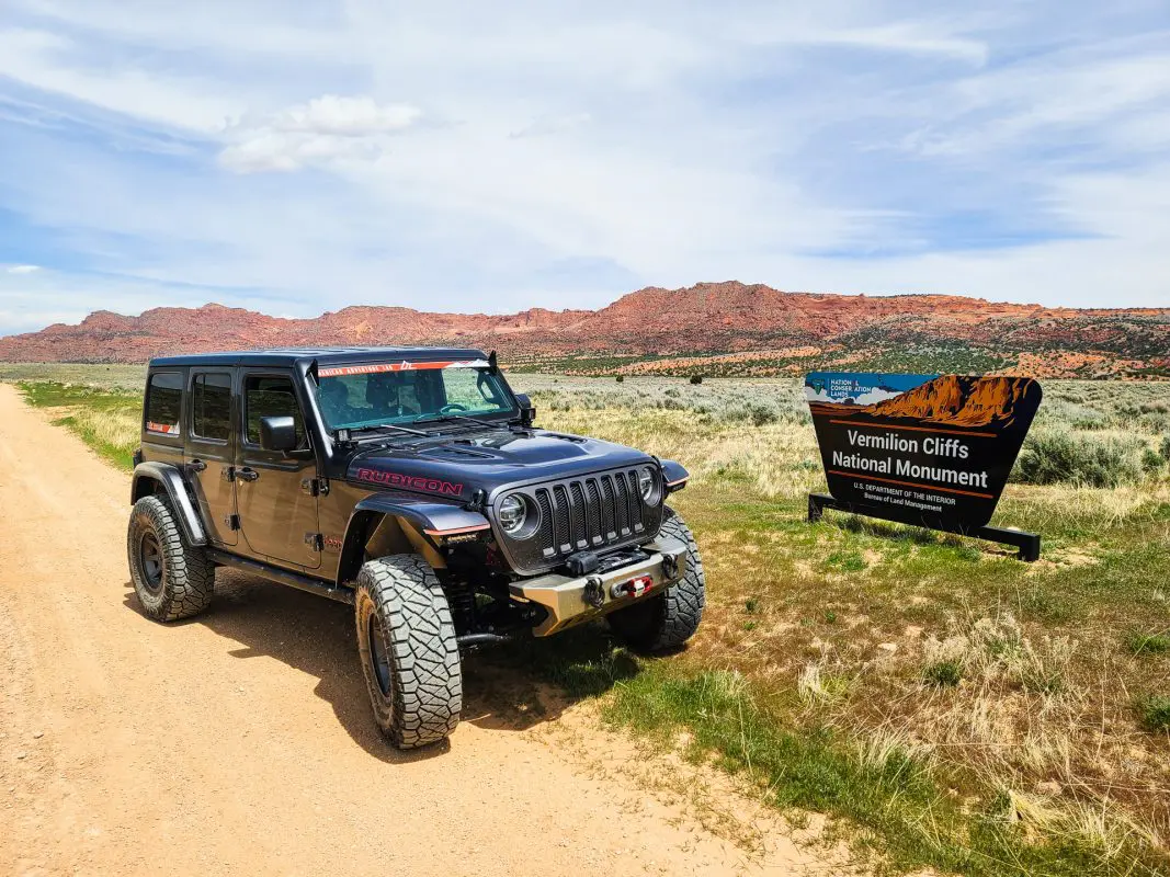
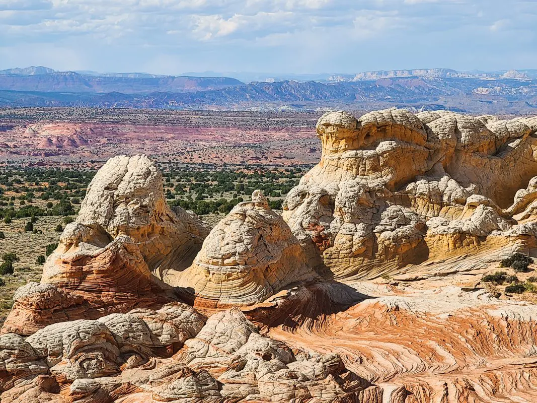

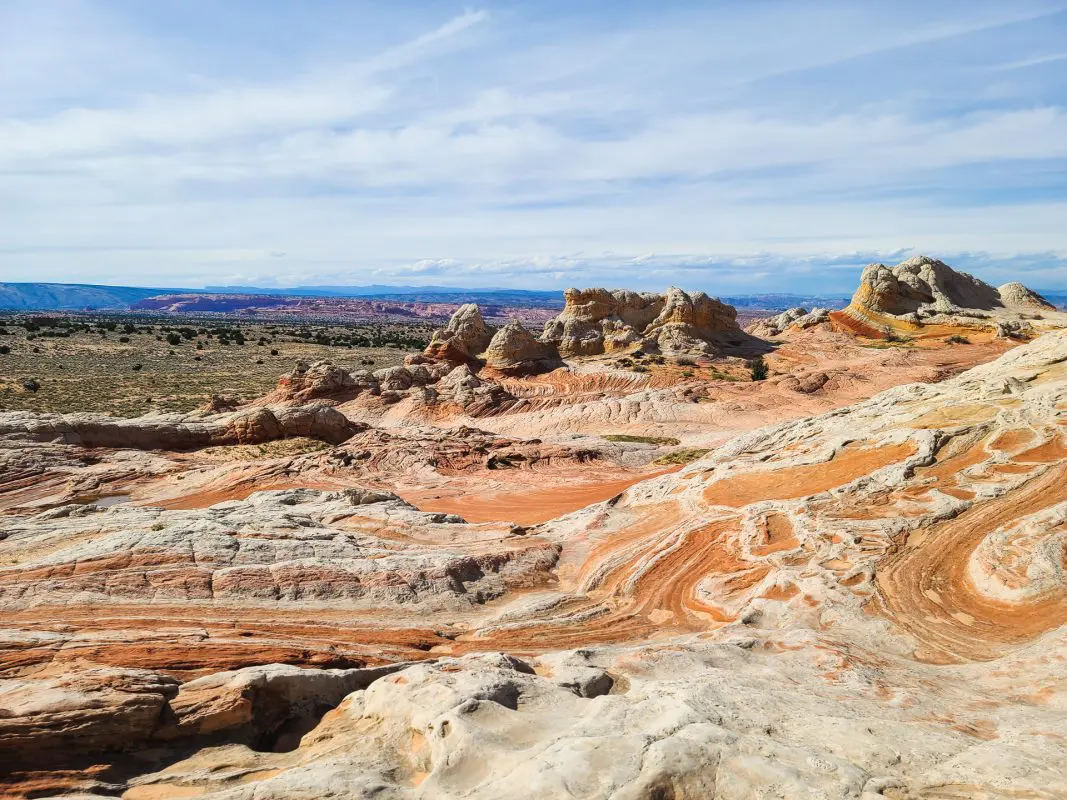
We opted to travel south from the White Pockets trail route for a better view of the Vermillion Cliffs National Monument. House Rock Rd also gives access to HWY 89 which leads to the northern rim of the Grand Canyon. From this gravel road, the Condor Release Area can be visited which is a super cool stop!
Hitting the pavement at House Rock heading west leads to the Northern Rim of the Grand Canyon. Though it was still closed for winter at the time of our trip, this is an outing worth mentioning. Less commercialized that the Southern Rim, the Northern Rim has spectacular views of the Colorado River as well as lodge with a dinning room overlooking the view.
And of course, food!
We hoped that one of our favorite stops along the way, Jacob Lake Inn, would be open since the Northern Rim was still closed. And it was open! If you are anywhere near, you should stop by and pick up some cookies. You’ll be glad you did! This is what this Inn is known for. They are baked fresh daily and a great trail snack on an otherwise desolate road.

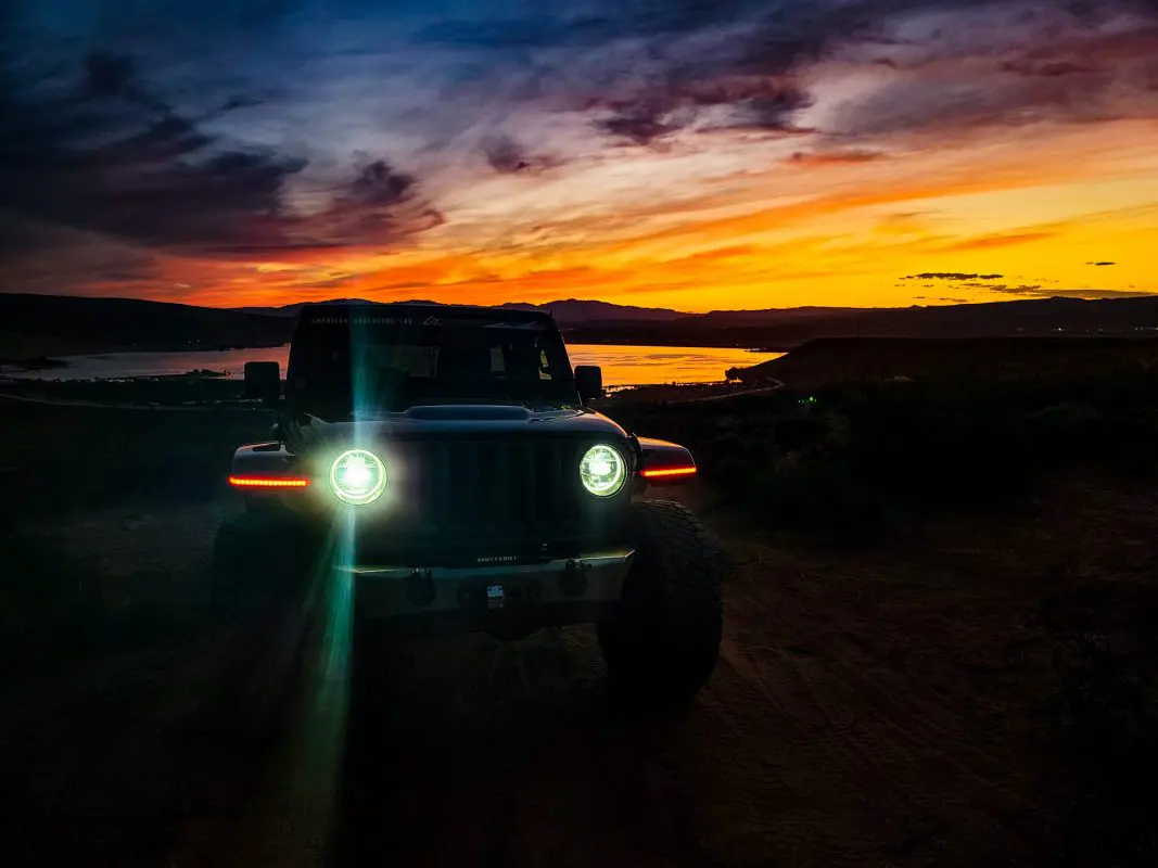
Sunset Overlook Above Sand Hollow
After taking the long way back to St George, we continued through Sand Hollow State Park. Topping the hill above the lake, I just couldn’t pass up a sunset like this. What an amazing ending to a great day of exploring!